Pasture, Range and Forage (PRF) Insurance offers land managers the opportunity to insure their hay and pasture acres. PRF uses rainfall estimates from the National Weather Service. At the end of the insurance period, the Risk Management Agency (RMA) uses the accumulated rainfall to calculate an index used to determine indemnities.
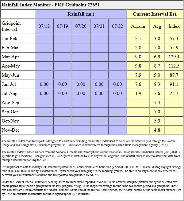
The PRF insured historically has not been able to track their rainfall accumulation or know whether or not they are due an indemnity until the RMA reported their results. For PRF insureds in Missouri we have created a product that allows them to daily track the rainfall amounts used by the RMA and know their index.
The report below is provided to all persons who sign up to receive one. It provides the NWS estimates of precipitation for the preceding 5 days, the accumulated precipitation for each 2-month insurance period, the average rainfall over that 2 month period and the calculated index used to determine insurance payouts.

To receive periodic PRF reports for your particular location, go to http://agebb.missouri.edu/horizonpoint/begin.htm. You will need to provide an email address, street address, the latitude and longitude of your farm.
To find your latitude and longitude you can go to http://agforceusa.com/rma/ri/prf/maps and zoom in on your location. When you find your farm on the aerial photograph, left mouse click on it and it will give you the latitude and longitude of the location (see video).